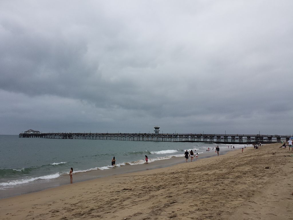
In Los Angeles, we don’t appreciate anyone raining on our parades. Fortunately for us, it only rains an average of 33 days a year here. That being said, we’ve seen dramatically less of the sun this spring. And that trend has been continuing throughout the month thanks to a phenomenon we affectionately refer to as June Gloom. While pretty much every Angeleno is familiar with June Gloom, they don’t really tell you about it when you’re shopping for homes in LA. So, for those moving here from out of state, allow us to acquaint you with this decidedly unusual phenomenon that more or less visits us at the beginning of every summer.
A Portrait of June Gloom

At the beginning of June, we’re not quite in summer yet. But the drugstores have already crammed their holiday aisles with pool floats, coolers, and American flags. And most of the electric fans have already sold out.
But glancing outside, we see a scene far different than any we’d want to mail on a postcard to a distant loved one, wishing they were here. Instead, we’re treated to gray as far as the eye can see. A dense blanket of funereal clouds looms over Southern California, keeping the intensity of the sun at bay.
Sometimes there’s fog. Maybe even a bit of drizzle. On a rare occasion, we may even get a bit of legitimate rain. By lunchtime, in most cases, the dismal sky has burned away, revealing the summery stratosphere behind it. But that’s assuming the marine layer is merciful.
June Gloom Isn’t Confined to a Single Month

Sometimes June Gloom skips us. Other years, we get it for several months (like this year). It’s given way to a slew of other grim nicknames including:
- Graypril
- May Gray
- No-Sky July
- Fogust
But on average, May and June produce the cloudiest months on the SoCalendar. And lucky us! The conditions that create June Gloom are nearly exclusive to our specific region. So, what are those conditions exactly?
The Perfect St… Well, It’s Not Quite a Storm Really…
A precise orchestration of atmospheric and oceanic conditions is responsible for June Gloom. Basically, the air near the surface of the sea is cooled by the California Current. As the water cools the air to a temperature lower than the air in higher altitudes, low altitude clouds begin to form. This leads to an atmospheric inversion further magnified by a drop in higher air pressure from the subtropical ridge. Currents around Catalina Island even play a role.

All of these intricate moving parts seem to find their nexus in Southern California every May or June. Voila! June Gloom descends, leaving us wanting to sleep in and gorge on comfort food. The gloom is particularly persistent with La Niña in the mix. But when El Niño comes out to play, we may not get a June Gloom at all.
Here Comes the Sun
So a cooler spring means a cooler summer, right? Sorry, but there’s a reason why Rite Aid is already cleared out of fans. Experts are already telling Angelenos to prepare for a hotter than usual summer. And we’re inching toward it this week.
A low pressure trough has basically been stagnating in the atmosphere above Southern California. But the experts say that trough is gradually weakening day by day. So, here comes the sun, folks. Just be careful what you wish for!

Comments
Post a Comment